
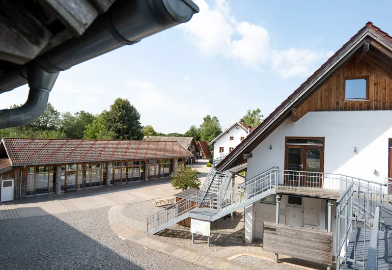

2 Photos
Umweltstation Unterallgäu
CampsiteGermany
Nearby
- Bathing spot, outdoor pool1.5 km
- Lake1.5 km
- River2.1 km
- Hiking trails2 routes
- Cycle routes9 routes
Water
- Beach
- Illerstrand5.4 km
- Beach9.8 km
- Lake 11 nearby
- Regenerationsteich1.5 km
- Rotisweiher3.2 km
- Bad Clevers5.8 km
- River 3 nearby
- Iller2.1 km
- Bathing spot, outdoor pool 5 nearby
- Naturfreibad Legau1.5 km
- Warmwasserfreibad "Im Tal"8.1 km
- Warmwasserfreibad Altusried8.2 km
Outdoors
- Hiking trailsBayerisch-Schwäbischer Jakobsweg MM-LI · Etappe 8 der Wiesengänger Route der Wandertrilogie Allgäu2 routes within 3 km
- Cycle routesIller-Radweg · Radverkehrsnetz Landkreis Unterallgäu und Memmingen · 4 - Illerblick RadReiseRegion · 1 - Altusrieder Rennradrunde9 routes within 3 km
- Climbing
- Bock4 km
- Kletterwald9.9 km
- Alpenverein13.7 km
- Horse riding
- Horse riding6.1 km
- Pferdesportpark Altusried8.1 km
- Golf and mini golf 6 nearby
- Golf and mini golf8.9 km
- Adventure Golf10.2 km
- Golfclub Wiggensbach-Waldegg e.V.11.7 km
- Ski area
- Gohrersberg – Kreuzthal14.7 km
Day trips
- Castle 9 nearby
- Schloss Lautrach5.3 km
- Schloss Kronburg5.7 km
- Hohes Schloss5.8 km
- Museum 12 nearby
- Schützenmuseum5.6 km
- Bauernhofmuseum Illerbeuren5.6 km
- Bauernhofmuseum Eingang5.6 km
- Zoo, animal or theme park
- Kinderbauernhof9.8 km
- Wildpark Oyhof / Tannheim14.7 km
- Viewpoint 7 nearby
- Viewpoint750 m
- Aussichtsturm2.9 km
- Viewpoint3.2 km
- Sight
- Wassertretanlage4.5 km
- Pestsäule5.4 km
- Nature reserve, national park
- Laubener Brunnen7.4 km
- Kiesgrube Aitrach9.7 km
Supplies
- Groceries 4 nearby
- Rapunzel1.2 km
- EDEKA1.6 km
- Penny1.7 km
- Bakery
- Bäckerei Konditorei Günther Landerer1.4 km
- Landbäckerei Sonntag1.4 km
- Restaurant, café 4 nearby
- Rapunzel Casino1.1 km
- Gasthof Löwen1.2 km
- Rapunzel Welt1.2 km
- Pharmacy 6 nearby
- Marien-Apotheke1.3 km
- Allgäu Apotheke6.7 km
- Andreas-Hofer-Apotheke7.6 km
- Petrol station 10 nearby
- Petrol station1.5 km
- Sunoil6.5 km
- Petrol station8.2 km
- Railway station
- Aichstetten6.5 km
- Bad Grönenbach8.6 km
Data: © OpenStreetMap contributors (ODbL) · straight-line distance · as of 26 October 2026
Reviews
No reviews yet. Be the first — sign in and share your experience.