


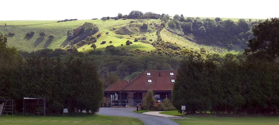
7 Photos
Southdown Way Caravan & Camping Park
CampsiteUnited Kingdom
- Price
- Kostenpflichtig
Description
Campsites near Southdown Way National Trail
Amenities
Nearby
- Lake2.5 km
- Bathing spot, outdoor pool4.4 km
- Hiking trails3 routes
- Cycle routes6 routes
- Climbing900 m
Water
- Lake 11 nearby
- Danny Lake2.5 km
- Slurry lagoon3.2 km
- Wintons Fishery3.4 km
- Bathing spot, outdoor pool 6 nearby
- Bathing spot, outdoor pool4.4 km
- Bathing spot, outdoor pool5.6 km
- Bathing spot, outdoor pool5.6 km
Outdoors
- Hiking trailsSouth Downs Way · Ditchling Beacon to Devil's Dyke, South Downs walk, Sussex East · European walking route E9, Queen Elizabeth Country Park to Jevington3 routes within 3 km
- Cycle routesBurgess Hill - Hassocks Cycle Route · Ditchling - Cooksbridge (ESCC Cycle Route 206) · National Cycle Route 20 Crawley - Pyecombe (proposed) · Hurstpierpoint to Downlands Communitiy College6 routes within 3 km
- Climbing
- Climbing900 m
- Climbing9.4 km
- Boulder Brighton10.6 km
- Horse riding 24 nearby
- Horse riding1.6 km
- Horse riding1.8 km
- Three Greys Riding School2.3 km
- Golf and mini golf 23 nearby
- Pyecombe Golf Course2 km
- Mid Sussex Golf Club3 km
- Singing Hills Golf Course4.8 km
Day trips
- Castle
- Lewes Castle - Shell Keep10.9 km
- Lewes Castle10.9 km
- Lewes Castle - Barbican gate11 km
- Museum 25 nearby
- Museum5.3 km
- Stanmer Craft Museum5.6 km
- Preston Manor8.2 km
- Zoo, animal or theme park
- Phileas Foggs World of Adventures5.4 km
- Wallaby Enclosure14.5 km
- Viewpoint 5 nearby
- Viewpoint150 m
- Viewpoint1.1 km
- Viewpoint1.6 km
- Sight 27 nearby
- Ditchling Museum of Art + Craft1.3 km
- Clayton Holt1.4 km
- Jack Windmill1.6 km
- Nature reserve, national park 28 nearby
- Stoneywish Nature Reserve1.6 km
- Wolstonbury Hill2 km
- Batchelors Farm Nature Conservation Site2.8 km
Supplies
- Groceries 20 nearby
- Keymer Stores700 m
- The Sussex Grocer900 m
- Orion Convenience Store950 m
- Bakery
- Bake Out950 m
- Restaurant, café 13 nearby
- Aroma700 m
- The Corner Cafe950 m
- Tim Fai1 km
- Pharmacy 37 nearby
- Day Lewis Pharmacy950 m
- Ditchling Pharmacy1.3 km
- Hopkins Pharmacy4.2 km
- Petrol station 32 nearby
- Esso1.7 km
- Pycombe (South) Services3.2 km
- Texaco3.8 km
- Railway station 13 nearby
- Hassocks1.3 km
- Burgess Hill4.2 km
- Plumpton5.3 km
- Bus stop 9 nearby
- St Edwards Church600 m
- St Cosmas Church600 m
- Beacon Hurst650 m
Data: © OpenStreetMap contributors (ODbL) · straight-line distance · as of 26 October 2026
Reviews
No reviews yet. Be the first — sign in and share your experience.