



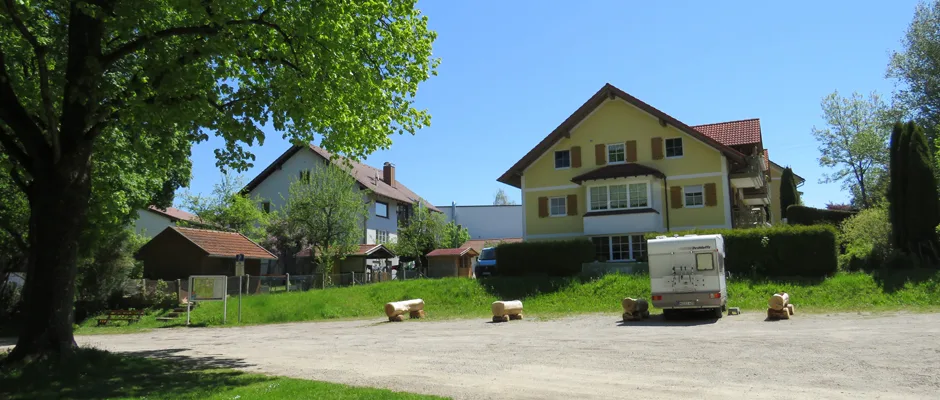
8 Photos
Parkplatz am Wellenfreibad Peiting
Motorhome stopoverGermany
- Price
- Kostenlos
- Pitches
- 5 pitches
Nearby
- Bathing spot, outdoor pool50 m
- Lake550 m
- River1.5 km
- Hiking trails5 routes
- Cycle routes8 routes
Water
- Beach 8 nearby
- Beach5.4 km
- Beach5.5 km
- Badeplatz Lugenauer See6.2 km
- Lake 13 nearby
- Gumpen550 m
- Einweichbecken1.3 km
- Wassertretanlage2.4 km
- River 9 nearby
- Lech Werkskanal1.5 km
- Lech1.5 km
- Bathing spot, outdoor pool 6 nearby
- Wellenbad Peiting50 m
- Bathing spot, outdoor pool2.1 km
- Hallen-Freibad "Plantsch"2.5 km
Outdoors
- Hiking trailsWeitwanderweg Romantische Straße ROT - FÜS · Via Romea - Deutschland - Bayern · LechErlebnisWeg · Heilige Landschaft Pfaffenwinkel - Westschleife5 routes within 3 km
- Cycle routesAmmer-Amper-Radweg · Allgäu-Radweg · [D9] Weser-Romantische Straße Teil 10 · Sachsenrieder Bähnle8 routes within 3 km
- Climbing
- DAV Kletterzentrum Peißenberg10.3 km
- Boats and canoes
- Bootshaus Schongau2.4 km
- kajakverein-schongau3.4 km
- Horse riding 4 nearby
- Sternenstunden-Reithalle4.3 km
- Reit-und Fahrstall Mayr5.2 km
- Reitverein5.7 km
- Golf and mini golf 6 nearby
- Golf and mini golf1.8 km
- Golf and mini golf3.2 km
- Golfplatz Stenz11 km
Day trips
- Museum 14 nearby
- Museum im Klösterle600 m
- Stadtmuseum3 km
- Strumpfmuseum5.4 km
- Zoo, animal or theme park
- Schongauer Märchenwald und Tierpark1.9 km
- Wildgehege13.8 km
- Viewpoint 13 nearby
- Viewpoint750 m
- Viewpoint2.3 km
- Viewpoint2.7 km
- Sight 15 nearby
- Gestiefelter Kater2 km
- Rapunzel2 km
- Slackline2 km
- Nature reserve, national park 10 nearby
- Ammertal im Bereich der Ammerleite und Talbachhänge3 km
- Schwarzlaichmoor4.2 km
- Oberoblander Filz4.7 km
Supplies
- Groceries 20 nearby
- Naturmarkt Peiting350 m
- V-MARKT650 m
- Aldi Süd800 m
- Bakery 10 nearby
- Sesar700 m
- Ihle1.1 km
- Imbiss Diti2.7 km
- Restaurant, café 38 nearby
- Tai Phuc50 m
- Hotel Restaurant Dragoner/Grubers Steak-Stube150 m
- Keppeler300 m
- Pharmacy 10 nearby
- Glückauf Apotheke350 m
- Marktapotheke350 m
- Apotheke am Hauptplatz400 m
- Petrol station 7 nearby
- Kurt Kehrer600 m
- Freie Tankstelle650 m
- Petrol station1.5 km
- Railway station 4 nearby
- Peiting Nord1 km
- Peiting Ost1.1 km
- Schongau2.7 km
- Bus stop 20 nearby
- Meierstraße200 m
- Mittelschule200 m
- Azamstraße300 m
Data: © OpenStreetMap contributors (ODbL) · straight-line distance · as of 26 October 2026
Reviews
No reviews yet. Be the first — sign in and share your experience.